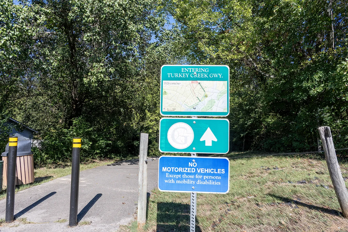
Part 3 of the Farragut, TN Greenway Trail Series
The Turkey Creek Greenway in Farragut, TN follows the Turkey Creek Road corridor near Anchor Park, Sailview and Brixworth. It also connects with a broader pedestrian network that includes the separately named Inverness Greenway, shorter Neighborhood Connectors, sidewalks and designated street routes.
The Inverness Greenway branches uphill near Anchor Park and Briarstone, providing connections to Briarstone, Easton Park and several portions of Inverness. Town signs identify the trail by name, and Google Maps shows the route, but it does not appear on the Town’s primary greenway map.
Together, the Turkey Creek and Inverness routes form part of the northern portion of Loop C. This guide documents how the named greenways, neighborhood connections and route transitions work on the ground.
At a Glance: Where Does the Turkey Creek Greenway Run?
The Turkey Creek Greenway follows the Turkey Creek Road corridor near Anchor Park and the Brixworth and Sailview subdivisions. The Town’s detailed greenway page describes a 1.6-mile asphalt trail with an additional 0.3-mile spur to Turkey Creek Woods between Sailview and Brixworth.
The Town’s primary greenway map, however, labels the Turkey Creek Greenway as 1.1 miles.
Based on my field review, the named route begins on its eastern side near the junction with the Inverness Greenway and ends on the west beyond Brixworth, before reaching Sheffield. A separately signed branch extends toward Banbury Road and Black Powder Drive, where the off-street trail transitions to neighborhood streets.
At Banbury Road, the off-street greenway transitions to neighborhood streets.
Understanding the Northern Side of Loop C
The Town of Farragut identifies three long exercise routes—Loops A, B and C—on its official greenway map.
These are not continuous off-street greenways. The Town describes them as combinations of:
- Greenways
- Sidewalks
- Streetways
Loop C is listed at approximately 6.4 miles. The Turkey Creek Greenway forms an important portion of that loop, but completing the circuit requires moving among different types of pedestrian infrastructure.
That is why the route can be confusing when viewed only as a colored line on a map. One section may be a wide paved greenway, the next a residential street without sidewalks and the next a short connector marked only by bollards.
Part 3 follows the Turkey Creek and Inverness portion of that network. Part 4 continues through Sheffield, Kings Gate, Brookmere, the Virtue Road/Little Turkey Creek Greenway and the Kingston Pike corridor.
Where Does the Turkey Creek Greenway Begin and End?
For purposes of this guide, I describe the route from east to west. At the Inverness junction, the named greenway and the broader pedestrian route diverge: the greenway continues west, while the Turkey Creek Road sidewalk continues east toward Bridgewater and Concord Road.
West of the junction, the paved route passes Sailview and Brixworth. Its main line ends before reaching Sheffield, while a separately signed branch turns toward Banbury Road and Black Powder Drive.
At Banbury Road, however, the off-street trail ends. The route then continues along Banbury Road and Black Powder Drive as a streetway without continuous sidewalks.
This distinction matters. The broader pedestrian network continues, but the physical experience changes from a separated paved trail to neighborhood streets before reaching another connector.
Could the Turkey Creek Greenway Eventually Extend Farther West?
The Town of Farragut has studied a project described in various public records as the Turkey Creek Greenway extension and the Turkey Creek Road Multimodal Improvements project. The proposed route would extend west from the greenway’s present endpoint beyond Brixworth toward Sheffield and the bridge over Little Turkey Creek near Virtue Road. If completed, it would fill one of the most noticeable gaps in this portion of Loop C and provide a more direct connection with the Little Turkey Creek Greenway.
The Town’s FY2026 Capital Investment Program included funding for the proposed project. A preliminary design was deferred by the Farragut Municipal Planning Commission in May 2024 after nearby property owners raised concerns about its potential effects. Further planning has also been delayed while an earlier dispute involving properties along the proposed route remains unresolved.
Project status as of October 2026: The extension is not an open trail, and I found no approved final design or confirmed construction schedule. Until that changes, the existing Loop C route continues through Banbury Road and Black Powder Drive before using the bollard-marked connector to reach Witherspoon Lane in Sheffield. I follow that existing route and its connections with Sheffield, Kings Gate and the Little Turkey Creek Greenway in Part 4 of this series.
What Continues East of the Inverness Junction?
Although the named Turkey Creek Greenway appears to begin near its junction with the Inverness Greenway, the pedestrian route does not end there.
A sidewalk continues east along Turkey Creek Road to the entrance of Bridgewater. Bridgewater does not have sidewalks throughout the subdivision, so the Turkey Creek Road sidewalk should not be interpreted as a continuous internal neighborhood route.
Beyond the Bridgewater entrance, a short paved connector marked by bollards at both ends leads between Turkey Creek Road and Anchorage Circle in the Turkey Creek Harbor condominium community. Google Maps labels the path “Turkey Crk Hbr.” There is no Town of Farragut sign identifying the connector by name, so this guide refers to it descriptively as the Turkey Creek Harbor connector.
Continuing east along the Turkey Creek Road sidewalk instead of turning onto the condominium connector eventually reaches the Concord Road sidewalk.
This creates three distinct types of access east of the Inverness junction:
- A roadside sidewalk continuing toward Concord Road
- Street access at the Bridgewater entrance
- The bollard-marked Turkey Creek Harbor connector between Turkey Creek Road and Anchorage Circle
The distinction is important because the named Turkey Creek Greenway and the broader pedestrian network do not share exactly the same endpoints. The greenway designation may change, but the connected pedestrian route continues.
Why the Network Resembles a T
Near Anchor Park and Briarstone, the Turkey Creek and Inverness routes meet at a T-shaped junction.
The Turkey Creek route forms the horizontal portion of the T, while the Inverness Greenway climbs away from Turkey Creek Road between Briarstone and Inverness.
From the Turkey Creek Road sidewalk, the junction may appear like an upside-down T because the Inverness route extends uphill. The shape depends on the direction from which it is viewed, so this guide simply refers to it as a T-shaped junction.
This junction is the key to understanding the northeastern side of the network.
Someone staying on the Turkey Creek route can continue east or west. Turning onto the Inverness Greenway leads uphill toward Briarstone, Easton Park and several portions of Inverness.
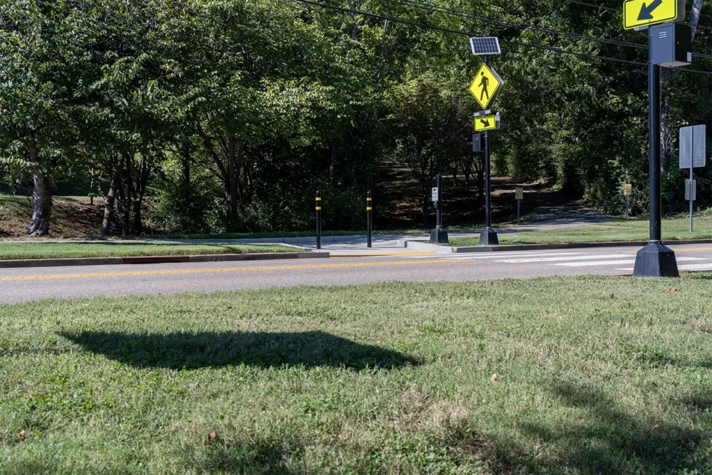
Anchor Park: The Primary Public Access Point
Anchor Park is the most clearly established public starting point for the Turkey Creek Greenway.
The Town identifies Anchor Park as the designated parking location for the trail. The park is located at:
11730 Turkey Creek Road
Farragut, TN 37934
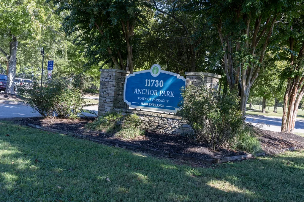
Starting at Anchor Park allows walkers and cyclists to access the Turkey Creek Road corridor without beginning inside one of the surrounding subdivisions.
Anchor Park also provides a useful visual reference for locating the Inverness junction, Briarstone and Easton Park. Those connections are nearby, but their relationship is much easier to understand on foot than from the Town’s primary map.
The Inverness Greenway: The Signed Trail Missing from the Town Map
The Inverness Greenway is a separately named, Town-signed trail that connects directly with the Turkey Creek Greenway.
Although I have not found a Town source stating whether it is formally considered part of the Turkey Creek Greenway, it functions as one of the most important neighborhood branches in this part of Farragut.
The route climbs between Briarstone and Inverness before ending near Bobolink Road and Bunting Drive in the Audubon Hills subdivision. Several shorter paths branch from it along the way.
Its omission from the Town’s primary greenway map helps explain why it can be overlooked. Even someone familiar with Anchor Park or the Turkey Creek Greenway may not realize how many residential connections extend from this one uphill branch.
The trail is labeled on Google Maps, but the map alone does not clearly explain where each shorter connector leads. I walked the main route and its branches to identify their actual endpoints.
Inverness Greenway Neighborhood Connections
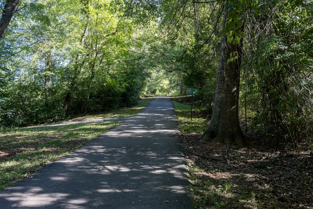
Briarstone Lane and Easton Park
The first short branch on the left is an approximately 150-foot connector leading to Briarstone Lane.
Across the street, another path continues toward Easton Park Subdivision. That route passes behind the residential area and continues toward its entrance across from Anchor Park.
Briarstone has sidewalks along one side of its streets, allowing the connector to feed into a broader neighborhood pedestrian route.
Spring Branch Lane
The next short branch extends approximately 150 feet to the right and reaches the Spring Branch Lane cul-de-sac in Inverness.
The endpoint is near a neighborhood parking area and pool. Bollards and the paved trail make the connection identifiable once someone knows where to look.
Hidden Grove Road and Hawkstowe Lane
A third branch extends approximately 200 feet toward the Hidden Grove Road and Hawkstowe Lane portion of Inverness.
This connection provides access to another section of the neighborhood without requiring pedestrians to follow the main subdivision entrance route.
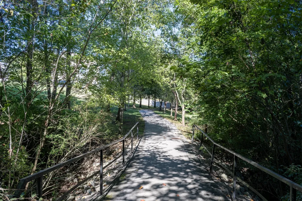
The Fenced Endpoint Near Royal Way Lane
Farther along Hawkstowe Lane, a short paved path extends approximately 50 feet toward Royal Way Lane in the Kings Gate subdivision.
Geographic proximity—and the way the path appears on Google Maps—may suggest that it connects Hawkstowe with Royal Way Lane, Cross Bridge Drive and Red Mill Lane. It does not.
The path ends at a fence approximately four feet high, with no pass-through connection between the two areas at that location.
This is an important example of why an apparent connection on a map does not always translate into practical pedestrian access.
Bobolink Road and Bunting Drive
After the final branches, the main Inverness Greenway continues a short distance before ending near Bobolink Road and Bunting Drive in Audubon Hills subdivision.
Unlike Briarstone, Inverness does not have sidewalks throughout the neighborhood. The greenway and its short branches therefore serve as important off-street connections between several sections of the subdivision and the Turkey Creek corridor.
The Painted Turtle–Inverness Sidewalk Connection
Painted Turtle is a small residential area situated between the Inverness Greenway and the main Inverness entrance.
At the rear of Painted Turtle, an approximately 25-foot sidewalk provides a direct pedestrian connection with Inverness.
This is not a direct branch from the Inverness Greenway. It is better classified as a short neighborhood-to-neighborhood pedestrian connection.
Although physically small, it demonstrates how Farragut’s broader network works. A short sidewalk, cul-de-sac path or gap between two residential areas can materially change where someone can walk without returning to a major road.
How Sailview and Brixworth Relate to the Greenway
The Town states that the Turkey Creek Greenway connects Brixworth, Kingsgate and Sailview with Anchor Park.
After walking the route, I would add an important practical distinction: a neighborhood may border or front a greenway without having a separate connector branching into every portion of the subdivision.
Sections of Brixworth and Sailview front the Turkey Creek Greenway, but I did not find multiple dedicated internal connector trails climbing into those neighborhoods along the main route.
Practical access may instead occur through subdivision entrances, adjoining streets or specific endpoints along the greenway.
This does not contradict the Town’s description. It clarifies what “connects” can mean on the ground. The greenway serves the neighborhoods, but access does not necessarily take the form of a clearly marked path behind every group of homes.
The Banbury Road Branch
Between Sailview and Brixworth, a short branch extends from the main Turkey Creek greenway toward Banbury Road and Black Powder Drive.
Bollards and a Town sign at Banbury identify the paved segment as the Turkey Creek Greenway. The layout resembles another small T: the main route runs east and west while the Banbury segment forms the short vertical branch.
At Banbury, the separated trail ends and the mapped exercise route continues through neighborhood streets.
Banbury Road and Black Powder Drive do not have continuous sidewalks. Walkers following the broader Loop C route therefore move temporarily onto a streetway before reaching the next off-street connection.
The street route leads to a connector at the end of Witherspoon Lane in Sheffield. Bollards mark both ends of that connector.
That Sheffield connection is where Part 3 hands the route to Part 4.
Greenway, Sidewalk or Streetway?
The central lesson from this portion of Loop C is that it is not one continuous greenway. The route shifts among named greenways, Neighborhood Connectors, roadside sidewalks, bollard-marked transitions, and residential streets without sidewalks.
Those distinctions affect practical access. A subdivision bordering the greenway is not necessarily the same as a home having a direct route from its street. Buyers should verify the exact route from an individual property rather than relying solely on its apparent proximity to the trail.
What I Verified in Person
For this guide, I walked the Turkey Creek and Inverness Greenways, their neighborhood branches, and the transition toward Sheffield. I confirmed the connections serving Briarstone, Easton Park, Spring Branch Lane, Hidden Grove Road, Hawkstowe Lane, Bobolink Road, Bunting Drive, and Painted Turtle, along with the fenced endpoint near Royal Way and the signed Banbury Road endpoint.
This fieldwork revealed connections that do not appear on the Town’s primary greenway map and clarified several places where the map or surrounding street pattern might suggest a connection that does not exist.
Interactive Turkey Creek and Inverness Greenway Map
The interactive map accompanying this article identifies:
- The main Turkey Creek Greenway
- Anchor Park
- The Inverness Greenway
- Neighborhood connectors
- Confirmed endpoints
- The fenced Hawkstowe endpoint
- The Banbury streetway transition
- The handoff toward Sheffield and the remainder of Loop C
Open the Interactive Turkey Creek and Inverness Greenway Map Full Screen →
The routes shown are based on published maps and personal field observations. Conditions, access points and route designations can change. Confirm current conditions before relying on the map for a particular trip.
What Should Buyers Verify About Greenway Access?
A home can appear close to a greenway without offering a direct or uninterrupted route to it.
Before relying on trail access as part of a home-buying decision, verify:
- Where the nearest usable entrance is located
- Whether the route begins inside the neighborhood or outside its entrance
- Whether sidewalks are continuous
- Whether any portion requires walking along residential streets
- Whether apparent connections end at fences or private property
- Whether the grade is practical for the intended user
- Whether bicyclists must dismount at any transitions
- Whether public parking is available
- How the route performs in the intended direction of travel
These details cannot always be determined from a listing description or an online map.
Frequently Asked Questions
How long is the Turkey Creek Greenway?
Town sources currently provide different figures. The Town’s primary greenway map labels the Turkey Creek Greenway as 1.1 miles. Its detailed greenway webpage describes a 1.6-mile asphalt trail with an additional 0.3-mile spur to Turkey Creek Woods.
The difference may reflect different endpoints, route definitions or versions of the network. This guide reports both published figures rather than presenting one as conclusively correct.
Where can the public park for the Turkey Creek Greenway?
The Town of Farragut identifies Anchor Park at 11730 Turkey Creek Road as the public parking location for the Turkey Creek Greenway.
Is the Inverness Greenway part of the Turkey Creek Greenway?
The Inverness Greenway connects directly with the Turkey Creek route and functions as a major branch of the surrounding pedestrian network.
Town signs identify it separately as the Inverness Greenway. I have not found a Town source formally stating that it is part of the Turkey Creek Greenway, so this guide treats it as a separately named connecting greenway.
Why is the Inverness Greenway difficult to find?
The trail is identified by Town signs and appears on Google Maps, but it does not appear on the Town’s primary greenway map. Its entrance can also resemble one of several smaller neighborhood branches unless someone knows where the main route leads.
Does the Hawkstowe trail connect with Royal Way Lane?
No. Although the two areas are geographically close, the path terminates at a fence and does not provide pedestrian access to Royal Way Lane.
Do Brixworth and Sailview have direct access to the Turkey Creek Greenway?
The Town describes the Turkey Creek Greenway as connecting Brixworth and Sailview with Anchor Park. However, access should be evaluated from the specific street or home. I did not find multiple dedicated internal connector trails leading from the main route into every portion of the two subdivisions.
Does the Turkey Creek Greenway connect with Kings Gate?
The broader Loop C pedestrian network reaches Kings Gate, but the complete route is not one uninterrupted greenway. It includes the Banbury and Black Powder streetway, a Sheffield connector and additional greenway, sidewalk and street segments covered in Part 4.
Is all of Loop C on a paved greenway?
No. The Town specifically describes its exercise loops as combinations of greenways, sidewalks and streetways. Some portions are separated paved trails, while others require using sidewalks or residential streets.
Sources and Field Verification
Official sources used for this guide include:
- Town of Farragut Greenway Map
- Town of Farragut: Farragut Greenways
- Town of Farragut: Parks and Greenways
- Town of Farragut FY2026 Annual Budget and Capital Investment Program
Additional reporting reviewed for the proposed Turkey Creek Road project includes:
- “Planning Commission delays action after hearing residents’ concerns,” farragutpress, May 22, 2024
- “Concerns mount over greenways, property use and Town planning,” farragutpress, April 8, 2026
Route descriptions, neighborhood connections and endpoint observations were personally field-checked in September 2026. Approximate distances for shorter connections should be treated as estimates.
Project names, proposed alignments and construction schedules may change. Dated project-status notes reflect the most recent Town documents and reporting reviewed when each article was updated.
Continue to Part 4: Completing Loop C
Parts 1 and 2 introduced Farragut’s broader trail network and explored Central Farragut’s school connections. Part 3 followed the Turkey Creek and Inverness Greenways along the Turkey Creek Road side of Loop C.
Part 4 is now available: Virtue Road and Little Turkey Creek Greenway: Completing Loop C in Farragut, TN
Part 4 picks up the route at Banbury Road and Black Powder Drive, continues through Sheffield and Kings Gate toward the Virtue Mill Waterwheel, and then follows the Little Turkey Creek Greenway through Brookmere and toward Kingston Pike to complete Loop C.
Looking for a Home Near Farragut’s Greenway Network?
Not every home near a greenway has the same type of access.
One property may have a short connector at the end of its street. Another may require following neighborhood roads before reaching the same trail. Two homes that appear equally close on a map can provide very different practical routes.
I have been walking, photographing and mapping these connections to document where they actually lead and how the different pieces of Farragut’s pedestrian network fit together.
If greenway access is important to your home search, I can help you evaluate the route alongside the property itself.
Search Farragut Homes for Sale →
Explore More Farragut Neighborhood and Greenway Guides →
David Hamilton, REALTOR®
Weichert, Realtors – Advantage Plus
Cell: 865-284-HOME
Office: 865-474-7100
Email: david@davidhamilton.com


1 thought on “Turkey Creek Greenway in Farragut, TN: Exploring Inverness and Loop C”