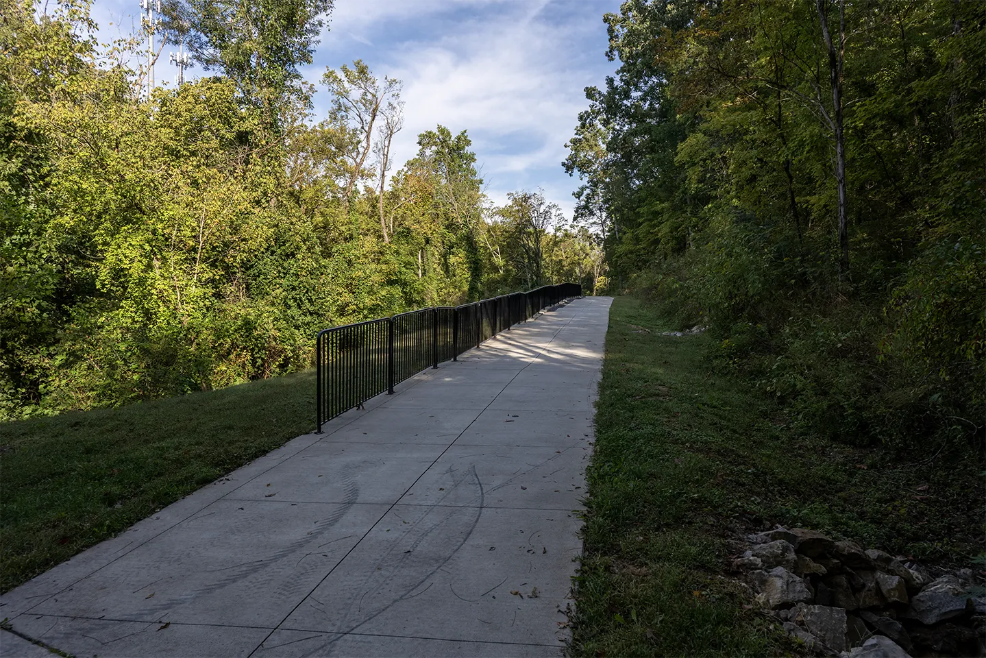
Part 4 of the Farragut, TN Greenway Trail Series
Loop C demonstrates how Farragut’s pedestrian network operates beyond its individually named greenways.
The Town of Farragut lists Loop C as an approximately 6.4-mile exercise route made from a combination of greenways, sidewalks and streetways. Its western and southern portions connect the Turkey Creek corridor with Sheffield, Kings Gate, Brookmere, the Virtue Road/Little Turkey Creek Greenway, Sugarwood, Kingston Pike and Concord Road.
The route is continuous as a pedestrian network, but it is not one uninterrupted off-street trail. Following the complete loop requires understanding where a greenway becomes a neighborhood connector, where sidewalks begin or end and where the route temporarily follows residential streets.
Part 3 covered the Turkey Creek and Inverness Greenways along the along the Turkey Creek Road side of Loop C. Part 4 continues from the Turkey Creek Greenway’s Banbury Road branch and follows the remaining connections around the loop.
At a Glance: What Makes Up the Rest of Loop C?
From the Turkey Creek Greenway’s Banbury Road endpoint, Loop C continues through a mixture of residential streetways and paved pedestrian connections.
The route follows Banbury Road and Black Powder Drive before using a bollard-marked connector to reach Witherspoon Lane in Sheffield. From Sheffield, two separate paved trails continue in different directions: the Inglecrest Lane–Carlyle Drive connector leads into Kings Gate, while the Sheffield Greenway Connector leads toward the Virtue Mill Waterwheel and Little Turkey Creek Greenway.
Near the waterwheel, the Sheffield Greenway Connector meets the Little Turkey Creek Greenway. The route then continues through the roundabout at Brookmere’s front entrance, crosses the Virtue Road entrance to Sugarwood and follows Virtue Road to Kingston Pike.
At Kingston Pike, Loop C turns east and continues through a combination of greenway segments and sidewalks. It passes Sugarwood’s Kingston Pike entrance and the Kings Gate entrance before reaching Campbell Station Road. The route then turns right and follows the connected pedestrian path toward Concord Road, where the sidewalk continues back to Turkey Creek Road and closes the larger Loop C circuit.
Why Loop C Is More Than One Greenway
The name “Loop C” can create the impression of a single circular trail. On the ground, it is better understood as a connected route assembled from several types of infrastructure:
- The Turkey Creek Greenway
- The Inverness Greenway
- Neighborhood Connectors
- The Sheffield Greenway Connector
- The Virtue Road/Little Turkey Creek Greenway
- Sidewalks along residential and major roads
- Residential streetways without sidewalks
- Short transitions marked by bollards
The Town’s greenway map uses different line styles for greenways, sidewalks and streetways. Those distinctions matter because the surface, separation from vehicles and character of the route change as someone follows the loop.
From Banbury Road to Sheffield
The western branch of the Turkey Creek Greenway reaches Banbury Road near Black Powder Drive.
The paved trail ends at bollards and a Town of Farragut sign identifying the Turkey Creek Greenway. From that point, Loop C transitions to neighborhood streets.
Banbury Road and Black Powder Drive do not have continuous sidewalks. This portion of the route is therefore a designated streetway rather than a separated greenway or sidewalk.
Following the mapped route leads to a short connector between Black Powder Drive and the end of Witherspoon Lane in Sheffield. Bollards mark both ends of this connector, making the transition easier to identify once someone knows where to look.
This is one of the clearest examples of how Loop C changes form:
- The paved Turkey Creek Greenway reaches Banbury Road.
- The route continues along residential streets without sidewalks.
- A short bollard-marked connector enters Sheffield.
- Sidewalks resume within Sheffield.
Someone looking only for a continuous paved trail could easily assume the route ended at Banbury.
Project update — October 2026: A proposed Turkey Creek Road multimodal project could eventually provide a more direct connection from the Turkey Creek Greenway’s western terminus beyond Brixworth toward Sheffield and the bridge over Little Turkey Creek. No final plan has been approved, however, and the project’s design and schedule remain unresolved. For now, the existing Loop C route continues along Banbury Road and Black Powder Drive before using the bollard-marked connector to reach Witherspoon Lane in Sheffield.
Walking Through Sheffield
Sheffield has sidewalks along one side of its streets, allowing the route to continue beyond the Witherspoon Lane connector.
The neighborhood occupies an important position within Loop C because it contains pedestrian connections toward both Kings Gate and the Virtue Road/Little Turkey Creek corridor.
Two connections are particularly important:
- The Inglecrest Lane–Carlyle Drive connector leading toward Kings Gate
- The Sheffield Greenway Connector leading toward Virtue Road and the Virtue Mill Waterwheel
These paths provide different functions. One creates a neighborhood-to-neighborhood connection, while the other continues toward a named greenway and a primary trail junction.
The Sheffield–Kings Gate Connection
A short paved connector links Inglecrest Lane in Sheffield with Carlyle Drive in Kings Gate.
Carlyle Drive is reached from the Midhurst area of Kings Gate. Bollards mark both ends of the connector.
This connection allows pedestrians to move between Sheffield and Kings Gate without returning to the principal subdivision entrances or using the major-road perimeter.
It also helps explain the Town’s statement that the broader Turkey Creek Greenway network serves Kings Gate. The practical route is not a single greenway running directly into the subdivision. Access is created through a combination of:
- The Turkey Creek Greenway
- The Banbury and Black Powder streetway
- The Witherspoon Lane connector
- Sheffield sidewalks
- The Inglecrest Lane–Carlyle Drive connector
That is a more complicated route than the word “connects” may initially suggest, but the individual pieces do form a connected pedestrian network.
The Sheffield Greenway Connector
The Sheffield Greenway Connector extends from the Inglecrest Lane area toward Virtue Road.
Google Maps identifies this path by name, and bollards help define its entrances. The route passes through the wooded area behind the surrounding homes before reaching the Virtue Mill Waterwheel area near the Vista subdivision.
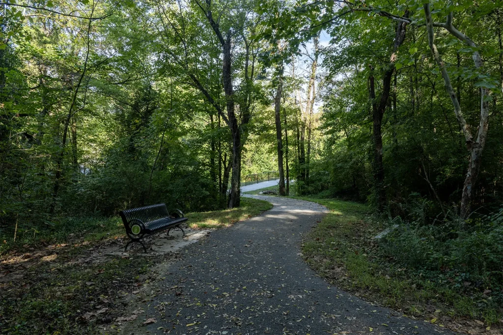
At the western end, the Sheffield Greenway Connector meets the Little Turkey Creek Greenway.
This junction is one of the most important transition points within Loop C because it brings together:
- The Sheffield route
- The Little Turkey Creek Greenway
- Access toward Brookmere
- The Virtue Road corridor
- Limited public greenway parking
- The Virtue Mill Waterwheel
- A Civil War history marker
The Virtue Mill Waterwheel: Where the Greenway Meets Farragut History
The Virtue Mill Waterwheel is more than a convenient landmark along Loop C. The large metal wheel is the surviving remnant of the historic Virtue Mill, which stood beside Little Turkey Creek and served this area beginning in the mid-1800s.
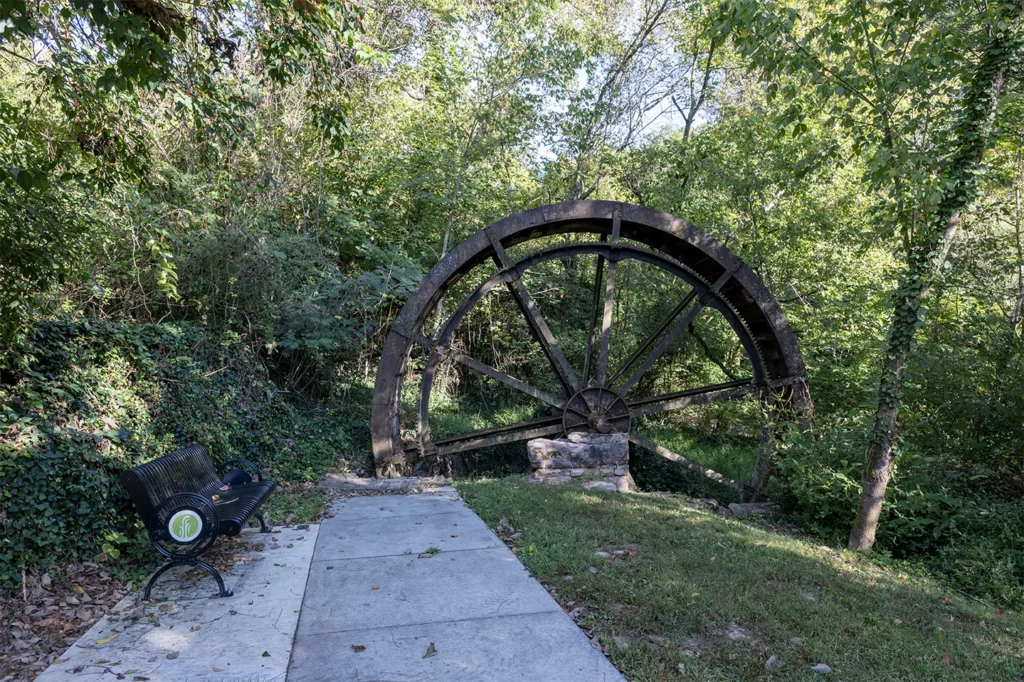
The mill operated at different times as a gristmill and community gathering place. Historical accounts also associate the site with a store and post office. Efforts were underway to preserve and restore the mill when fire destroyed the structure on June 2, 2002. The waterwheel remained, preserving one of the few visible connections to the property’s earlier history.
Today, a short paved path leads from the three-space parking area on Virtue Road to the waterwheel. This is also an important junction in the pedestrian network: the Sheffield Greenway Connector approaches from the north, while the Little Turkey Creek Greenway continues toward Brookmere, Sugarwood and Kingston Pike.
The location also figured in the Battle of Campbell Station during the Knoxville Campaign. On November 16, 1863, members of the 17th Michigan Volunteer Infantry made a stand in this vicinity as Union forces withdrew toward Knoxville ahead of Confederate forces commanded by General James Longstreet. A historical marker beside the greenway explains the engagement and the regiment’s role.
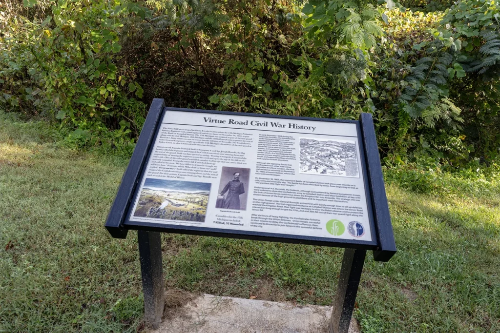
That combination makes the waterwheel one of the most distinctive stops on Loop C. In a single location, walkers encounter a neighborhood connection, a greenway junction, a surviving Farragut landmark and a documented Civil War site.
The Vista Greenways and Farm at Willow Creek: A Transition Toward McFee Road
West of Virtue Road, Vista contains three paved greenway connections. Two link different portions of the Vista subdivision, while a third provides a connection between Vista and The Farm at Willow Creek subdivision immediately behind it.
From The Farm at Willow Creek, a separate wooded trail extends from the Lone Willow Drive area to Evans Road, approximately midway between Virtue Road and McFee Road. Together, these paths create a connected route through two subdivisions, but the final segment reaching Evans Road belongs to The Farm at Willow Creek rather than Vista.
This sequence makes the Vista and Farm at Willow Creek paths an important transition in Farragut’s broader pedestrian network. Part 4 documents how the route extends west from the Virtue Road area through Vista and The Farm at Willow Creek to Evans Road. A later installment covering the McFee Greenway will examine what continues from this area toward McFee Road and McFee Park.
For now, the main Loop C route continues from the Virtue Road junction along the Little Turkey Creek Greenway toward Brookmere and Sugarwood.
The Little Turkey Creek Greenway
The Town’s primary map combines the Virtue Road and Little Turkey Creek sections under the name Virtue Road/Little Turkey Creek Greenway and lists the route at approximately 1.5 miles.
Near the Virtue Mill Waterwheel, the Little Turkey Creek Greenway branches from the Sheffield connection and follows the creek corridor toward Brookmere.
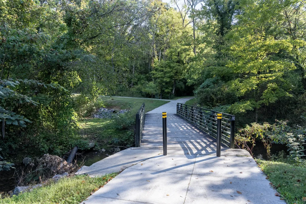
One branch reaches Needlegrass Lane in Brookmere. The route also continues toward Virtue Road, allowing pedestrians to move between the neighborhood, the creek corridor and the larger Loop C route.
The wooded setting and multiple branches can make this section appear less direct than the straight-line route shown on a conventional map. The waterwheel junction and bollards are therefore useful reference points.
How Brookmere Fits Into the Network
Brookmere occupies a key transition area between the Turkey Creek, Sheffield, Kings Gate and Virtue Road portions of Loop C.
The neighborhood does not connect directly with Sheffield by an internal residential street. Instead, the Little Turkey Creek Greenway provides the pedestrian connection between the two areas.
Brookmere’s principal entrance is on Virtue Road. A newer road connection at the rear of the neighborhood reaches West Kingsgate Road and provides vehicular and street access toward Kings Gate.
These routes give Brookmere more than one relationship with the surrounding network:
- The Little Turkey Creek Greenway connects the area toward Sheffield.
- Needlegrass Lane provides neighborhood access to the greenway.
- Virtue Road carries the main loop toward Kingston Pike.
- The rear street connection leads toward Kings Gate.
For purposes of understanding Loop C, Brookmere functions as a hinge between the Turkey Creek side of the network and the Virtue Road corridor.
From Brookmere Along Virtue Road
Near the roundabout at the Brookmere entrance, the pedestrian route continues along Virtue Road.
Following the route toward Kingston Pike, the greenway crosses the Virtue Road entrance to Sugarwood and continues to the traffic signal at the intersection of Virtue Road and Kingston Pike.
This portion remains part of the named Virtue Road/Little Turkey Creek Greenway corridor.
The Sugarwood entrance is an important reference point because the route changes again after reaching Kingston Pike.
From Virtue Road to the Sugarwood Entrance on Kingston Pike
At the traffic signal, the pedestrian route turns east along Kingston Pike.
An off-street greenway segment extends east from the Virtue Road intersection, passes NHC HealthCare and continues to Sugarwood’s Kingston Pike entrance.
This is distinct from the longer section east of Sugarwood, which consists primarily of sidewalks.
The change may not be obvious to someone following the route casually because both portions provide a paved pedestrian surface. For mapping and route descriptions, however, the greenway segment and sidewalk corridor should be identified separately.
The Kingston Pike Sidewalk Return
East of Sugarwood’s Kingston Pike entrance, Loop C continues primarily along sidewalks.
The route passes the Kingston Pike entrance to Kings Gate and proceeds toward Campbell Station and Concord Road.
Kingston Pike is a major roadway, so this portion differs considerably from the wooded Little Turkey Creek Greenway and the quieter neighborhood connectors earlier in the loop. Pedestrians must also navigate subdivision entrances and roadway crossings along the corridor.
At Concord Road, the connected sidewalk route turns toward Turkey Creek Road. The Concord Road sidewalk eventually meets the Turkey Creek Road sidewalk described in Part 3, closing the Loop C circuit.
Loop C as a Complete Pedestrian Circuit
When viewed as a complete route, Loop C links several individually named trails and residential areas:
- Anchor Park
- Turkey Creek Greenway
- Inverness Greenway
- Briarstone
- Easton Park
- Inverness
- Sailview
- Brixworth
- Banbury Road
- Sheffield
- Kings Gate
- Brookmere
- Sugarwood
- Virtue Road/Little Turkey Creek Greenway
- Kingston Pike
- Concord Road
Not every neighborhood has the same type of connection. Some have a greenway entrance, some connect through sidewalks and others require following residential streets before reaching an off-street path.
That is why Loop C is more useful as a pedestrian-network concept than as the name of one trail.
Route-Surface Summary
Someone following Loop C encounters several different route conditions:
Separated paved greenways
- Turkey Creek Greenway
- Inverness Greenway
- Sheffield Greenway Connector
- Virtue Road/Little Turkey Creek Greenway
- Kingston Pike greenway segment near Virtue Road
Short Neighborhood Connectors
- Black Powder Drive–Witherspoon Lane
- Inglecrest Lane–Carlyle Drive
- Inverness and Briarstone-area connections described in Part 3
Sidewalks
- Portions of Sheffield
- Virtue Road approaches
- Kingston Pike east of Sugarwood
- Concord Road
- Turkey Creek Road east of the Inverness junction
Streetways without continuous sidewalks
- Banbury Road
- Black Powder Drive
- Selected neighborhood transitions
The route should therefore be evaluated segment by segment rather than treated as one uniform trail.
Who Might Use Loop C?
Loop C can support several different types of trips:
- A longer exercise route
- Access between adjoining neighborhoods
- Walking or bicycling toward Anchor Park
- Connections between Turkey Creek Road and Virtue Road
- Shorter neighborhood walks using only part of the loop
- Access to the waterwheel and Civil War marker
- A route toward Kingston Pike and Concord Road
Completing the full circuit is different from using one short section. Distance, roadway crossings, the streetway segments and changing sidewalk coverage should all be considered before beginning the entire loop.
Interactive Loop C Map
The interactive map accompanying this guide identifies:
- Named greenways
- Sidewalk segments
- Streetway transitions
- Neighborhood Connectors
- Bollard-marked entrances
- Public parking
- Confirmed endpoints
- The Virtue Mill Waterwheel junction
- The Civil War history marker
- The route that closes the circuit through Kingston Pike and Concord Road
Interactive Loop C Map Full Screen →
Routes are based on Town maps, Google Maps and personal field verification. Trail conditions, access points and route designations can change. Confirm current conditions before relying on the map for a particular trip.
What Should Buyers Verify Near Loop C?
Proximity to Loop C does not guarantee the same type of pedestrian access from every home.
Before relying on a particular route as part of a home-buying decision, verify:
- The closest practical entrance
- Whether the entrance is marked by bollards or signage
- Whether sidewalks are continuous from the property
- Whether the route requires using streets without sidewalks
- The number and type of roadway crossings
- Whether a nearby path actually passes through to the next street
- Whether access is public or limited to a particular community
- The distance to the portion of the network the buyer expects to use
- Whether the route is practical for walking, bicycling or a mobility device
A home can sit near a green line on a map while requiring a much longer or more complicated route to reach it.
Frequently Asked Questions
How long is Loop C in Farragut?
The Town of Farragut greenway map lists Loop C at approximately 6.4 miles.
Is Loop C one continuous greenway?
No. The Town describes its exercise loops as combinations of greenways, sidewalks and streetways. Loop C includes named greenways, short connectors, sidewalks and residential streets without continuous sidewalks.
How does the Turkey Creek Greenway connect with Sheffield?
The Turkey Creek Greenway reaches Banbury Road. From there, the route follows Banbury Road and Black Powder Drive before using a bollard-marked connector to reach Witherspoon Lane in Sheffield.
Does Sheffield connect with Kings Gate?
Yes. A short paved connector marked by bollards links Inglecrest Lane in Sheffield with Carlyle Drive in Kings Gate.
Where is the Sheffield Greenway Connector?
The Sheffield Greenway Connector extends from the Inglecrest Lane area toward the Virtue Mill Waterwheel and the Little Turkey Creek Greenway junction near Virtue Road.
Does Brookmere connect directly with Sheffield?
The neighborhoods do not connect through an internal residential street. The Little Turkey Creek Greenway provides the pedestrian connection between the Sheffield and Brookmere areas.
Where can visitors park for the Virtue Road/Little Turkey Creek Greenway?
The Town’s greenway map identifies parking along Virtue Road between Brookmere and Sheffield. The roadside pull-off near the Virtue Mill Waterwheel has limited capacity of approximately two or three vehicles.
Does Loop C reach Kingston Pike?
Yes. The Virtue Road/Little Turkey Creek route reaches the traffic signal at Kingston Pike. A greenway segment continues to Sugarwood’s Kingston Pike entrance, followed primarily by sidewalks toward Kings Gate and Concord Road.
Can someone bicycle the entire loop?
Much of the route is paved, but the complete loop includes bollards, roadway crossings, sidewalks and residential streetways without continuous sidewalks. Cyclists should evaluate each segment and current traffic conditions before attempting the full circuit.
Sources and Field Verification
Official and supporting sources used for this guide include:
- Town of Farragut Greenway Map
- Town of Farragut: Farragut Greenways
- Town of Farragut: Parks and Greenways
- Virtue Road Civil War History Marker
Route descriptions, neighborhood connections, sidewalk coverage, bollards and endpoint observations were personally field-checked in September 2026. Approximate distances and parking capacity are field estimates rather than surveyed measurements.
Coming Next in the Farragut Greenway Trail Series
Parts 3 and 4 documented Loop C—from the Turkey Creek and Inverness Greenways through Sheffield, Kings Gate, Brookmere, Virtue Road, Kingston Pike and Concord Road.
Coming next in Part 5: the series will continue geographically into Loop B. I’ll walk the mapped route and document the named greenways, sidewalk transitions, streetways and lesser-known neighborhood connections that make the loop work on the ground.
Looking for a Home Near Farragut’s Greenway Network?
Loop C shows why practical access matters as much as geographic proximity.
One home may have a bollard-marked connector at the end of its street. Another may require following neighborhood roads or crossing a major roadway before reaching the same network.
I have been walking, photographing and mapping these routes to document where they actually lead and how the different portions of Farragut’s pedestrian system fit together.
If greenway access is important to your home search, I can help you compare the route as carefully as the property itself.
Search Farragut Homes for Sale →
Explore More Farragut Neighborhood and Greenway Guides →
David Hamilton, REALTOR®
Weichert, Realtors – Advantage Plus
Cell: 865-284-HOME
Office: 865-474-7100
Email: david@davidhamilton.com


1 thought on “Virtue Road and Little Turkey Creek Greenway: Completing Loop C in Farragut, TN”