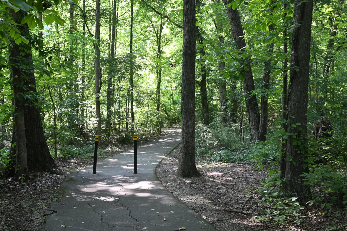
Farragut, Tn Greenway Trail Series | Part 1
Overview, Trail Network & Neighborhood Connections
Does Farragut, Tennessee have walking trails and greenways?
Quick Answer
Yes. The Town of Farragut has developed an extensive municipal greenway network with more than 25 trail segments totaling approximately 16 miles, according to the Town’s dedicated Farragut Greenways page. Another Town Parks & Greenways page currently lists the network at more than 20 miles, so published Town totals vary depending on the source.
A useful way to understand Farragut’s trail system is to view it as operating on two practical levels: longer named routes—referred to in this guide as Main Greenways—such as the Turkey Creek Greenway, Grigsby Chapel Greenway, and Parkside Greenway; and a secondary network of Neighborhood Connectors linking subdivisions with nearby sidewalks, schools, parks, neighborhoods, and trails. Some of these shorter paths also function as Feeder Trails by providing access toward a Main Greenway or another part of the broader network.
Together, these trails, sidewalks, and street connections help link homes, schools, parks, and commercial areas while reducing the need to travel along major roads such as Kingston Pike and Campbell Station Road.
Exploring Farragut, TN Greenway Trails: The Buyer’s Guide to Walkable Living
If you’re seriously researching a move to Farragut, its greenway trails deserve to be part of your first conversation about the community—not an afterthought you discover after you’ve unpacked the boxes.
For a buyer, the important question isn’t simply whether a home is located near a greenway. It’s whether the neighborhood provides a practical way to reach it. A short connector around the corner may offer more everyday value than a prominent trailhead that still requires a drive. That distinction—the difference between proximity and usable access—is one of the central ideas explored throughout this series.
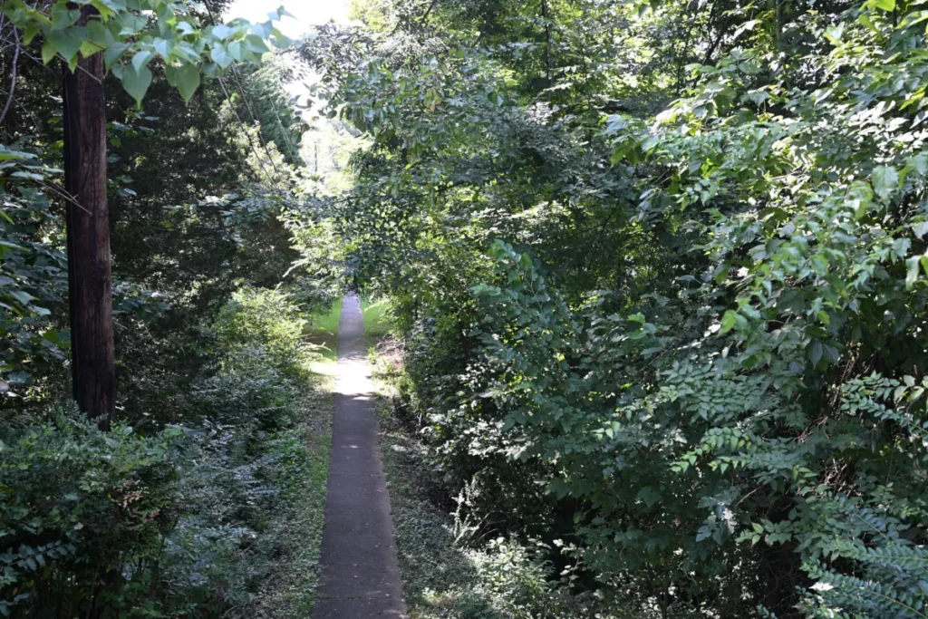
I’ve spent decades in this community, first as a contractor who watched these neighborhoods take shape and now as a REALTOR® helping buyers and sellers understand the details. The greenway system is one of Farragut’s most underappreciated community assets.
Most buyers don’t fully grasp what’s been built until they’re already living here. This series is designed to change that.
Understanding the Terms Used in This Guide
The Town of Farragut identifies more than 25 greenway-trail segments throughout the community, including several major named routes. But an official system map does not always show how the shorter, lesser-known paths function at the neighborhood level.
To make those relationships easier to understand, this guide uses three practical terms:
- Main Greenways are the longer, named routes shown on the Town of Farragut’s official greenway map, including the Turkey Creek Greenway, Grigsby Chapel Greenway, and Parkside Greenway.
- Neighborhood Connectors are shorter paved or natural-surface paths that link subdivisions with other neighborhoods, sidewalks, schools, parks, or nearby trails.
- Feeder Trails are neighborhood connectors that provide a route into a Main Greenway or another part of the broader trail network.
These are descriptive terms used throughout this guide, not formal classifications adopted by the Town of Farragut. A single path may also serve more than one purpose. For example, it may connect two subdivisions while also feeding residents toward a Main Greenway.
Viewed this way, Farragut’s trail system has two practical tiers: the prominent Main Greenways that form its backbone and the smaller Neighborhood Connectors and Feeder Trails that make portions of the network accessible from within established subdivisions.
Tier 1: Main Greenways — The Network’s Backbone
The first tier consists of the major named routes shown on the Town of Farragut’s official greenway map.
These include the Turkey Creek Greenway, Grigsby Chapel Greenway, Parkside Greenway, and other named corridors. They form the visible backbone of the system, providing longer paved stretches for walking, running, and cycling. The Town’s map also identifies the principal public parking locations from which residents and visitors can enter the network.
For buyers researching Farragut, proximity to a Main Greenway can be an appealing lifestyle feature. But distance alone does not tell the whole story. A home may appear close to a greenway while lacking a convenient neighborhood entrance, while another home may have practical access through a short path that is easy to miss on a standard map.
That is where the second tier becomes especially important.
Tier 2: Neighborhood Connectors and Feeder Trails — The Overlooked Links
The second tier consists of the shorter paths that help connect Farragut’s residential areas with nearby neighborhoods, sidewalks, schools, parks, and Main Greenways.
Some are Neighborhood Connectors linking one subdivision with another. Others function as Feeder Trails, carrying walkers and cyclists from a neighborhood toward a Main Greenway or another part of the trail system. Some paths perform both roles.
These connections vary considerably. Some are paved asphalt paths that resemble ordinary sidewalks. Others are natural-surface trails passing through wooded areas or neighborhood common spaces. Their entrances may be located behind a cul-de-sac, between homes, or along the edge of a subdivision, making them easy to overlook.
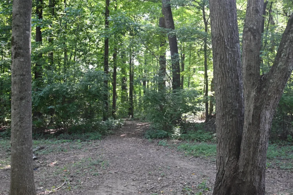
Many do not appear clearly on the Town’s main greenway map. Even when a path is visible on Google Maps, it may have no name or explanation of where it leads or what it connects.
Most of these connections have been part of my regular walks through central Farragut for approximately seven years. In preparing this guide, I revisited, photographed, and mapped the routes more systematically—and walked the Cottage Creek trail specifically to verify where it actually leads. That combination of long-term familiarity and on-the-ground verification revealed how the shorter paths fit together in ways that can be difficult to understand from a conventional map alone.
The connections covered in this guide serve Farragut View, The Cove at Turkey Creek, Cottage Creek, Woodland Trace, Stonecrest, and Sweet Briar. Depending on the neighborhood and route, they provide access to adjoining subdivisions, nearby sidewalks, the Farragut school campus area, and portions of the broader trail network.
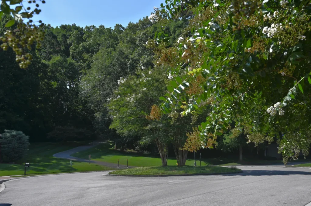
For residents of these neighborhoods, the practical benefit can be significant. Depending on the route, someone may be able to leave home and reach a nearby school, park, neighborhood, or Main Greenway without first driving to a designated trailhead. Some routes include sidewalks, street crossings, or short segments along neighborhood roads, so the exact experience varies by location.
Why Neighborhood Greenway Access Is a Real Estate Differentiator
From a real estate perspective, the distinction between being near a greenway and having practical access to it matters enormously—especially for buyers who prioritize walkability.
Proximity to a Main Greenway can be an appealing lifestyle feature, particularly for residents interested in longer walks, running, or cycling. But a nearby Neighborhood Connector may provide greater everyday convenience because it allows residents to enter the trail network directly from their neighborhood rather than driving to a designated trailhead.
That is the difference between a community that simply has trails and one in which trails are meaningfully connected to daily life. In portions of Farragut, Neighborhood Connectors help make that second experience possible.
As someone with 30 years of contracting experience, I’ve watched communities develop from the ground up. Paths, sidewalks, common areas, and connections between subdivisions can significantly affect how a neighborhood functions. When that infrastructure is present, it contributes to a more connected and usable community—not merely a collection of individual streets and homes.
The Full Picture: 25+ Segments, Two Tiers Working Together
Viewed through the two-tier framework used in this guide, here’s what Farragut’s broader greenway network delivers:
- More than 25 greenway-trail segments totaling over 16 miles, according to the Town of Farragut
- Main Greenways that provide longer routes for walking, running, cycling, and recreation
- Neighborhood Connectors, including paths that function as Feeder Trails, providing neighborhood-level access to other subdivisions, sidewalks, schools, parks, and portions of the broader trail network
- Connections to McFee Park, Anchor Park, Knox County school campuses, and the Turkey Creek commercial area
- Trail surfaces ranging from wide, paved multi-use paths to shorter natural-surface neighborhood connections
For people relocating to Farragut, this infrastructure offers something increasingly uncommon in suburban communities: a more connected lifestyle without necessarily giving up residential space or convenient access to schools, parks, and shopping.
Continue to Part 2: Walking to Farragut Schools
Part 1 established the two-tier framework used throughout this guide and explained why the difference between proximity and practical trail access matters to buyers.
Part 2 is now available: Walking to Farragut Schools: What Central Neighborhood Routes Actually Involve
Part 2 takes a closer look at Central Farragut and school connectivity—including how Neighborhood Connectors, sidewalks, and portions of the broader trail network create practical walking routes toward the Farragut Intermediate, Middle, and High School campuses.
Frequently Asked Questions About Farragut Greenway Trails
How many miles of greenway trails does Farragut, TN have?
The Town of Farragut reports more than 25 greenway-trail segments, although its published mileage totals vary by source. The Town’s dedicated Farragut Greenways information reports approximately 16 miles, while another Town Parks & Greenways page reports more than 20 miles. In this guide, the network is explained through two practical tiers: the longer named routes referred to as Main Greenways and the shorter Neighborhood Connectors that provide access between neighborhoods, sidewalks, schools, parks, and trails.
What is the difference between Farragut’s Main Greenways and Neighborhood Connectors?
Main Greenways are the longer named routes shown on the Town’s official map, including the Turkey Creek Greenway, Grigsby Chapel Greenway, and Parkside Greenway. Neighborhood Connectors are shorter paved or natural-surface paths linking subdivisions with nearby neighborhoods, sidewalks, schools, parks, or trails. When one of these connectors provides a route toward a Main Greenway or another part of the broader network, this guide also describes it as a Feeder Trail.
Which Farragut neighborhoods have Neighborhood Connectors?
The central Farragut connections covered in this guide include routes involving Farragut View, The Cove at Turkey Creek, Cottage Creek, Woodland Trace, Stonecrest, and Sweet Briar. These paved and natural-surface paths help connect neighborhoods with one another, the Farragut school campus area, and portions of the broader trail network.
Can you walk to the Farragut schools using these connections?
Yes. Neighborhood Connectors, sidewalks, and nearby streets provide pedestrian routes toward the Farragut Intermediate, Middle, and High School campuses from portions of central Farragut. The exact route and amount of street or sidewalk travel vary by neighborhood. Part 2 of this series explores those school connections in greater detail.
Are Farragut’s greenways suitable for longer-distance running or cycling?
Several Main Greenways—including the Turkey Creek Greenway and Grigsby Chapel Greenway—provide longer paved routes suitable for running, cycling, and fitness walking. Available distance, street crossings, parking, and connections vary by route, so users should review the Town’s map before planning a longer trip.
Do Farragut’s Neighborhood Connectors appear on the official Town map?
Not always. Some shorter neighborhood paths do not appear prominently on the Town’s main greenway map. Even when a path is visible on Google Maps, it may not be named or explain where it leads. The interactive map in this guide identifies several of these lesser-known connections and shows how they fit together.
Does the Farragut greenway system connect with the Turkey Creek area?
Yes. The Parkside Greenway extends through the Turkey Creek commercial area and connects with other portions of Farragut’s pedestrian network. The exact route may include greenway segments, sidewalks, and street crossings.
Are Farragut’s greenway trails dog-friendly?
Leashed dogs are commonly seen on Farragut’s greenways, but trail users should follow posted rules and Town requirements. Conditions on shorter Neighborhood Connectors can vary, particularly on natural-surface paths.
Is greenway access a factor in Farragut home values?
Direct greenway access can be an attractive lifestyle feature for buyers who prioritize walking, running, cycling, or convenient access to parks and schools. Its effect on market value varies by property, neighborhood, trail location, and buyer preferences, so it should be evaluated as one feature among many rather than assigned a universal dollar value.
Who maintains Farragut’s greenway trails?
The Town of Farragut maintains its municipal greenways and associated public infrastructure. Responsibility for shorter Neighborhood Connectors may vary depending on the location, ownership, easements, and subdivision arrangements. Residents should confirm responsibility for a particular path with the Town or applicable homeowners association.
Official Sources and Maps
- Town of Farragut — Parks & Greenways — Official Town information documenting more than 25 greenway-trail segments totaling over 20 miles.
- Town of Farragut — Farragut Greenways — Official Town information documenting more than 25 greenway-trail segments totaling approximately 16 miles.
- Town of Farragut Greenway Map — Named greenways, individual route mileage, parking locations, sidewalks, street connections, and exercise loops.
Source note: When this guide was researched on September 18, 2026, the Town of Farragut published two different mileage totals for its greenway network. The Town’s Farragut Greenways page reported more than 25 segments totaling approximately 16 miles, while its Parks & Greenways page reported more than 25 segments totaling over 20 miles. Both figures and sources are included here to accurately reflect the Town’s published information as of that date.
David’s Local Pro-Tip
🥾 The Most Useful Trail May Be the One That’s Easiest to Miss
When evaluating a home near Farragut’s greenway network, don’t rely solely on the distance shown on a map. Being close to a greenway does not necessarily mean a neighborhood has a practical way to reach it.
Some of Farragut’s most useful connections are short paths tucked between homes, behind cul-de-sacs, or along neighborhood common areas. They may resemble an ordinary sidewalk or a narrow opening into the woods, and some are difficult to identify on standard greenway maps. Yet one of these Neighborhood Connectors may provide more everyday value than a major trailhead located a mile or two away by road.
Before buying a home based partly on greenway access, walk the actual route. Find the neighborhood entrance, check the trail surface and grade, and follow it far enough to learn where it really leads. A five-minute Neighborhood Connector can completely change how accessible another neighborhood, a school campus, or the broader trail network feels from that location.
So how do you find these easily overlooked connections? That’s exactly why I created the interactive map below.
Explore Farragut’s Neighborhood Connectors
I’ve created an interactive map highlighting the Neighborhood Connectors covered in this series, including several paths that function as Feeder Trails into other portions of Farragut’s pedestrian network. The map shows how Farragut View, Stonecrest, The Cove at Turkey Creek, Cottage Creek, Woodland Trace, and Sweet Briar connect with one another, the Farragut school campus area, and portions of the broader greenway system.
These are neighborhood connections I’ve personally walked and documented, including several routes that can be difficult to identify on standard greenway maps.
Map Key: Neighborhood Connections Shown
The A and B markers identify the endpoints of each mapped route. The current map includes connections between:
- Farragut View and The Cove at Turkey Creek
- Woodland Trace and Sweet Briar
- Woodland Trace/Sweet Briar and The Cove at Turkey Creek
- Sonja Drive and the Farragut school campus area
- Parkside Greenway and Herron Road
- Cottage Creek and N Campbell Station Road
Select a route or endpoint on the map for a closer look, or open the map full screen for easier navigation.
🗺️ Open the Interactive Farragut Neighborhood Connector Map Full Screen
Please be considerate of nearby residents. Routes shown on this map are intended to help readers understand Farragut’s greenway, sidewalk, and neighborhood-connector network. Trail users should remain on established paths and public sidewalks, respect adjacent private property, follow posted signs, and avoid blocking neighborhood streets or driveways.
Buying or Selling Near Farragut’s Greenway Network?
Looking for a Home Near the Greenways?
Not all greenway access is equally practical. A home may appear close to a Main Greenway on a map but lack a convenient neighborhood entrance. Another home may seem farther away while benefiting from a Neighborhood Connector or Feeder Trail just around the corner.
Those details can affect how often you actually use the trail system. I’ve walked and mapped many of these lesser-known connections so I can help buyers look beyond simple distance and understand what greenway access from a particular neighborhood really involves.
If walkability, trail access, or proximity to Farragut’s parks and schools is important to you, I can help you evaluate those features objectively from any property you are considering.
Search Farragut Homes for Sale
Browse current Farragut listings and see which homes are available near the neighborhoods, parks, and greenway connections covered in this series.
🔍 Search Farragut Homes for Sale →
Does Your Neighborhood Have a Connection Buyers Might Miss?
Years ago, I didn’t know this network of neighborhood connectors existed—even though I lived one block from one. I discovered it only after my next-door neighbor pointed it out.
That experience is a good example of why hyperlocal knowledge matters when marketing a home. A seller may know every improvement made inside the property yet be unaware of a nearby path connecting the neighborhood with another subdivision, a school campus, a park, or a Main Greenway.
These connections should not be exaggerated or assigned an automatic dollar value. But when they exist, they can help tell a more complete story about the home’s location and the lifestyle it offers. Identifying and explaining details that buyers might otherwise miss is where genuinely local marketing has an advantage.
If you’re considering selling a Farragut home, an online estimate can provide a useful starting point. From there, we can look more closely at the property, its condition, its location, and the neighborhood features that should be part of its marketing.
🏡 See What Your Farragut Home Is Worth →
Have a Farragut Real Estate Question? Let’s Talk.
Whether you’re considering buying, selling, or simply planning ahead, I’m always happy to discuss the property, the neighborhood, and the details that may not be obvious from an online listing.
📱 Call or Text: 865-284-HOME
📞 Office: 865-474-7100
✉️ Email: david@davidhamilton.com
— David Hamilton, REALTOR® | Weichert, Realtors – Advantage Plus


4 thoughts on “The Ultimate Guide to Greenway Trails in Farragut, TN”